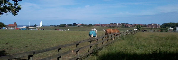
For the image today, Day 359 of the VM_365 project, we have a view in the Our Thanet series, taken from the crest of the hill at Elmwood Avenue and facing east across a valley cutting the chalk downland to reach the sea at Joss bay on the left side, between the Oast House and the North Foreland lighthouse.
The lighthouse stands at the northern end of the North Foreland promontory, an isolated chalk ridge which runs across the horizon in the picture and on which some of Thanet’s most significant prehistoric discoveries have been made. The North Foreland is one of the geographical features of the British Isles whose name (Kantion) was recorded in ancient literature by the 3rd century BC Greek explorer, sailor and navigator Pytheus of Massilia (modern Marseille).
On the valley slope to the right of the lighthouse a very complex cropmark of linear ditches and other features is often visible from the viewpoints around the valley. Excavations over many years have revealed that the cropmarks are the visible indicator of the very extensive prehistoric settlement that occupies the chalk ridge.
At the right hand end of the image, a large residential block marks the site of the former St. Stephens college, where one of the largest excavations took place in 1999 and 2003. Previous VM_365 posts have explored the Neolithic and Bronze Age funerary monuments that were positioned with care to overlook the valley. Close to the new residential block a small Bronze Age round barrow was excavated in 1999. In one terminal of a gap in the circuit, the excavators revealed an unusual burial which had been covered with a large piece of whalebone.
Examples of some of the earliest coins to have been produced by the Iron Age rulers of Kent have been found on the North Foreland, some connecting the area to the dynastic struggles that were affecting the people of Britain and the continent. The extensive Iron Age settlement produced many interesting finds, including a pair of Iron Bridle bits.
Another series of VM_365 posts explored the fascinating story that is told by the discovery of an Iron Age burial inserted into a large abandoned grain storage pit. Was this a casual burial or a more formal rite taking advantage of the prepared ground of the abandoned settlement? Three blue glass beads worn around the neck of the woman buried in the pit suggest the latter.
Several smaller sites have been excavated when the opportunity arises through house building or redevelopment on the estate that now encompasses the crest of the ridge. These have shown that the ridge was widely settled over a long period of time. One of the most significant finds was a Beaker period burial, discovered only a few centimetres below the drive of a house that had been built in the early 20th century. Archaeological monitoring of the house building plots has also shown that the ridge was heavily terraced while developing the estate and perhaps many archaeological sites were destroyed without record in the past.
The area is certainly one of the most important archaeological landscapes in the Isle of Thanet and much must remain to be learned about this area.