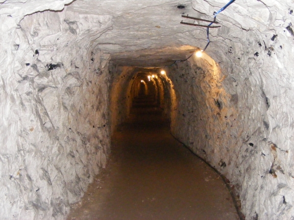
Today’s image for Day 344 of the VM_365 project shows a section of the World War II air raid tunnel system which was constructed under the town of Ramsgate in 1939.
The tunnel system exploited both the natural topography and geology of the town. The contours of the town, rise in all directions from the central valley around which the town developed from the 16th and 17th century onwards. The tunnel system follows this rise in the natural topography and encompassed the town, albeit below ground. The tunnels were cut into the chalk bedrock and chalk, if it is cut correctly, stabilises naturally and is self supporting, making it ideal for a deep underground system. In the picture above you can see the seams of flint that occur naturally in the chalk.
The tunnels were constructed beneath the road system of the town which avoided legal issues that might occur had the system extended below private properties. Most of the tunnels were left unlined as the average depth was approximately 21 metres below ground level which was considered safe to survive a direct hit from bombs on the ground above.
Ramsgate Tunnels are now open for guided public tours at weekends and during the week and are well worth a visit as the tour also covers aspects of the history of the Victorian railway tunnel which played it part in the World War II tunnels system. Advance booking is recommended and there is a free exhibition on Ramsgate’s part in Operation Dynamo, the Evacuation of Dunkirk in 1940.