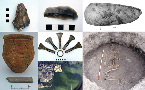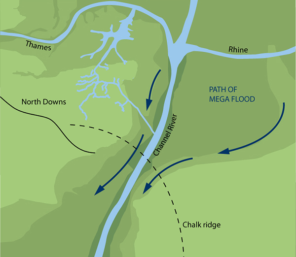
Today’s image is a map reconstructed by the Trust from various sources to show what our corner of Europe looked like at the end of the last Ice Age, approximately 10,000 years ago. Look carefully and you can see the outline of present day Thanet hidden among all that landmass although at that time it would just have been a hilltop overlooking the river valleys to the north and east.
Links
There are a series of maps and articles that give more background to the construction of the map here: dons maps ice age
The most detailed reconstruction of the formation of Thanet’s landscape, including the full explanation of map above is contained in a chapter of Augustine’s First Footfall, published by the Trust.